In the workshop ‘Creating grassroots initiative blueprints by mapping the city. Using participatory mapping tools to make a blueprint of a neighbourhood’ the possibilities of the participatory mapping tool called Measuring Amsterdam will be explored, followed by a co-creation session in which the value of the retrieved datasets are explored.
What you will get out of this workshop
Exploring the potentials of participatory mapping to help instigate grassroots initiatives
Workshop theme
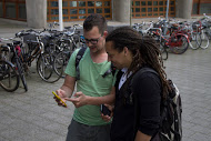
The idea of the workshop is to create blueprints that should help instigate change in a neighbourhood through responding to the right needs in grassroots initiatives. In the morning program we will map the city with the Measuring Amsterdam tool. The tool is designed as a smartphone application, which participants can use to map a neighbourhood. The blueprints are created based on the collected geo-located metadata with which maps can be made.
In the co-creation afternoon session, the groups will analyse the collected data and decide which idea is the most interesting or relevant to improve the neighbourhood. A canvas can be used by the participants to create their blueprints. This will demonstrate the different steps to get from the collected data to a blueprint.
Organisers
Wouter Meys – Amsterdam University of Applied Science, Citizen Data Lab
Maarten Groen – Amsterdam University of Applied Science, Citizen Data Lab
Nazli Cila – Amsterdam University of Applied Science, Digital Life Lab
Naomi Bueno de Mesquita – KU Leuven & Design Academy Eindhoven
Date and location
Workshop 4
Title: Creating grassroots initiative blueprints by mapping the city.
Date: 22/4 10:00 – 17:00
Location: TBA
More information on this workshop
Website: www.amsterdamcreativeindustries.com/grassroots-workshop
E-mail: m.n.groen@hva.nl

